
Fog and vapor hangs thick in the air as we drive westward
towards the rugged, veiled peaks of the Blue Ridge that shield the view of the
highlands beyond. Long sleeves and pants
wear heavy in the summer heat.
Threatening clouds stall on the horizon, but weather doesn’t matter when
your destination is underground.
David Small, student government and outdoor adventure
teacher at Fluvanna County High School; three Fluvanna grads, Travis, Chris,
and Small’s daughter, Erin; and I exit a road-seasoned Subaru at the
“trailhead” for the day’s adventure around midday. After a two-hour car ride, we are ready to
mobilize.
 |
| Photo by Matt Reilly |
Packs are filled with food, water, extra batteries, maps,
first aid supplies, and cameras.
Headlamps are double-checked for functionality. Boots are laced, and some tape their ankles
and wrists. Hardhats and gloves for
safety and tact are distributed and donned with firmness—a muted excitement and
acknowledgement of the risk involved with venturing underground.
 |
| Photo by Matt Reilly |
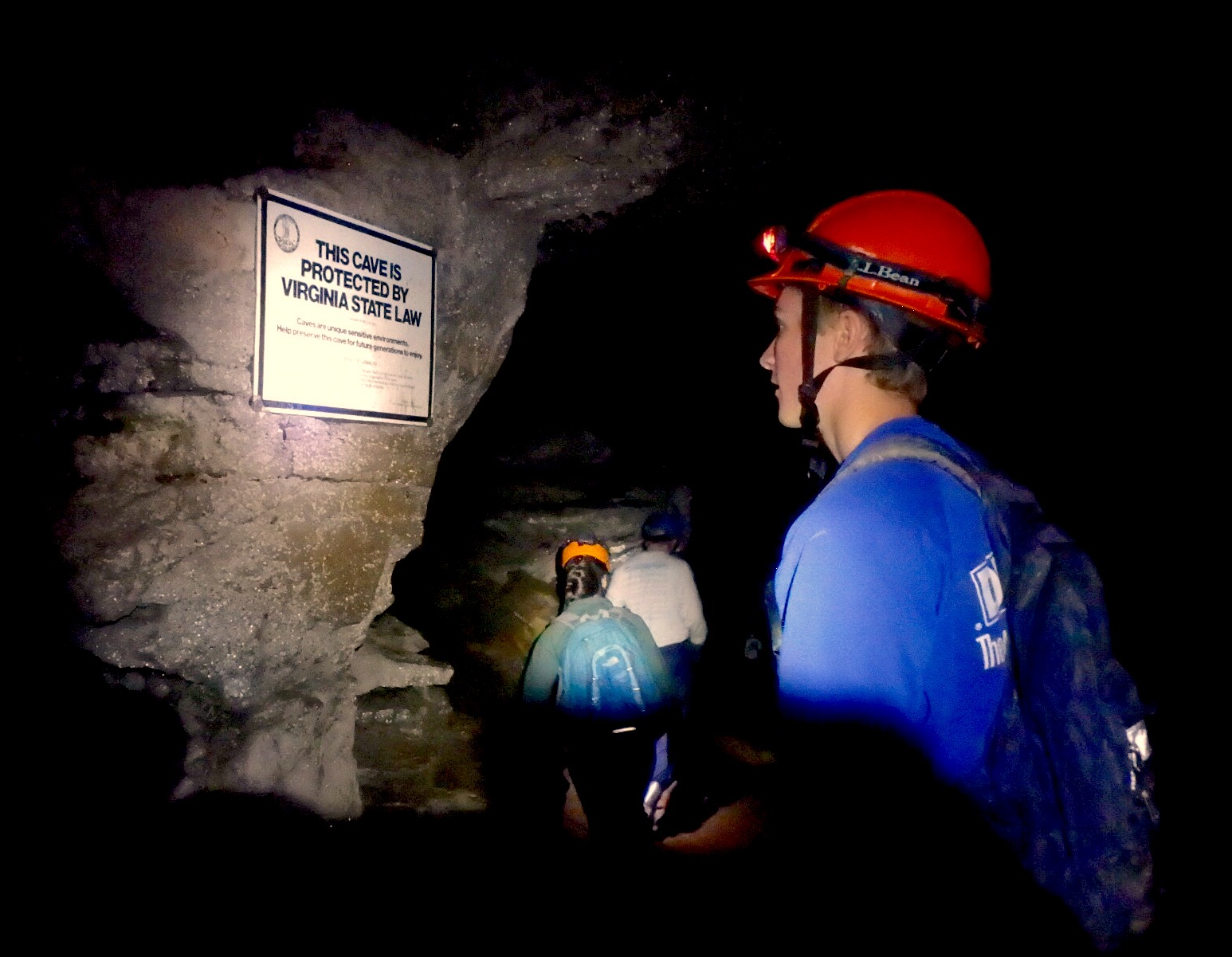
“The most dangerous part is getting to it!” Someone exclaims.
At the foot of the short foot trail marred by mud puddles
and root systems towers a rock face.
Only a small opening of about two feet offers advancement.
 |
| Photo by Matt Reilly |
Wriggling through the cave entrance, “breakdown”—a
collection of chunk rock indicative of the cave’s mouth crumbling—greets us. It is clearly visible in the twilight zone,
making footing easy—mere practice for what’s to come.
 |
| Photo by Matt Reilly |
Deeper we advance. Daylight
fades. The ceiling drops.
“Three points of contact,” Small announces encouragingly.
The ground becomes slick with mud; the footing,
technical.
 |
| Photo by Matt Reilly |
Hand. Hand. Foot.
Swing. A mental checklist becomes
subconscious. Footing is not hard to
come by in most circumstances, but lose balance or place a foot too far and you
may take a hard fall or break a leg in a hole.
Small is comfortable with his knowledge of the
passages—comfortable enough to navigate pitch dark with just a headlamp and a
map. However, for safety, we leave a
bread-crumb trail of yellow marking tape, placed directionally on visible rocks
at points of intersection. There are
countless opportunities to get lost here.
Even more in the dark.
 |
| Small checks the cave map. Photo by Matt Reilly |
Such is the allure of caves.
Unlike the first cave I ever explored, the entrance to this cavern is
tight. I have seen holes of equal and
larger size in my wanderings in the mountains on multiple occasions. Only this one is a portal to miles of
underground passages, and there are countless more within the cave, presumably
unexplored. There is great potential for
virgin, unexplored territory.
We reach an intersection.
The main passage swerves to the left.
A crag steeps to the left. A
length of mud-crusted para-chord used for navigation extends into the crag,
limp. Where does it lead?
We proceed without discovering the answer.
 |
| Freddy the Cave Frog. Photo by Matt Reilly |
If I had any prior inkling of the bowels of the Earth where
we tread, I would be referring to these sights with reference to specific locations,
officially dubbed on the map. But I am a
newcomer in this venue. Each new
encounter is a hard, muddy, and slippery obstacle and I love it. It’s a physical challenge to the other half
of the body’s muscles—the ones not used on an everyday basis.
“The Pit.” That
toponym does stick with me, if only for its blatant expression of
struggle. The main passage extends up,
through a tricky tunnel of boulders and sharp rocks. A pack will catch, and must be thrown or
handed up.
As is the case in many spots, the map indicates two possible
routes to the same end. The one that
Erin and I choose is an underground creekbed that travels underneath “The Pit,”
but requires a tight initial squeeze that soaks you to the bone with spring
water.
On the other end, we are met with what now seems like a
foreigner—a plump toad positioned at the mouth of the creek. The troglobite—or cave dweller—was assumed
blind for its habitation deep in the dark zone of the cave, and for its lack of
hopping reflexes when confronted.
 |
| Chris Markham attempts a tight squeeze. Photo by Matt Reilly. |
 |
| Checking the Cave Map at Short Man's Shortcut. Photo by Matt Reilly |
As we pushed on, the passage began to tighten. Eventually we found ourselves at what seemed
to be an impasse—“Short Man’s Shortcut.”
A dead-end offered only a 9-inch tall tunnel for advancement. None of us fit, and none wanted to push their
luck nearly a mile from daylight and under hundreds of tons of earth. But as we sat there in resignation, headlamps
fixed on the cave map, rumors of an underground river accessible through the
cave and the tight passage before us fueled our sense of adventure. There is always more to discover.
*Originally published in the Rural Virginian
No comments :
Post a Comment